Cumulus
Technology
Weather Satellites
ESP32
E-Ink Displays
Solar Cells
Fabrication
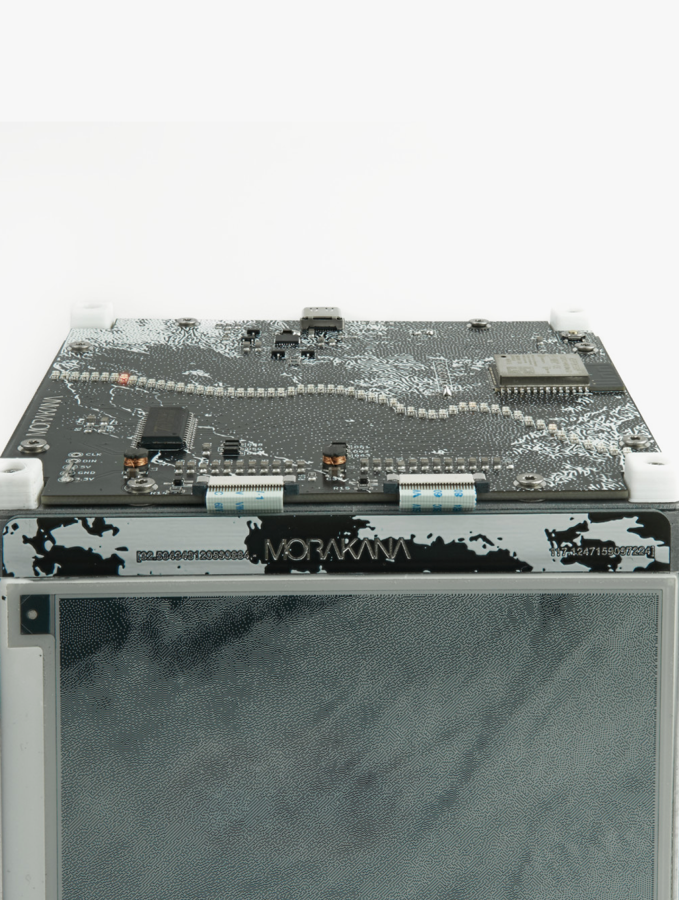
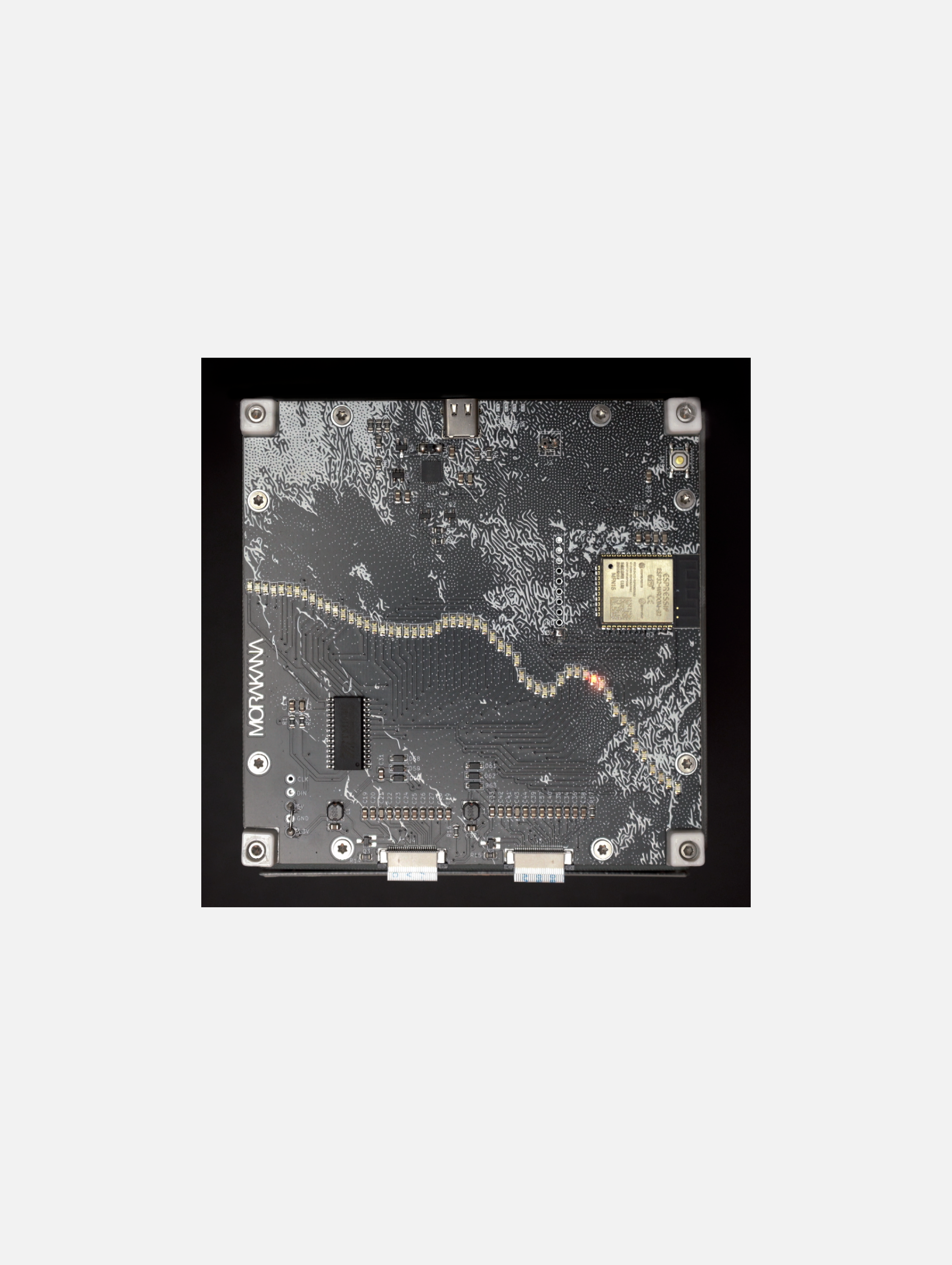
Custom PCB
Aluminium Framing
Support
Lumen Prize Gold Award 2025
NEW INC
Creative Capital
Dissolving Borders - New Latinx Art Collective
Currents New Media
Date
2022- 2025

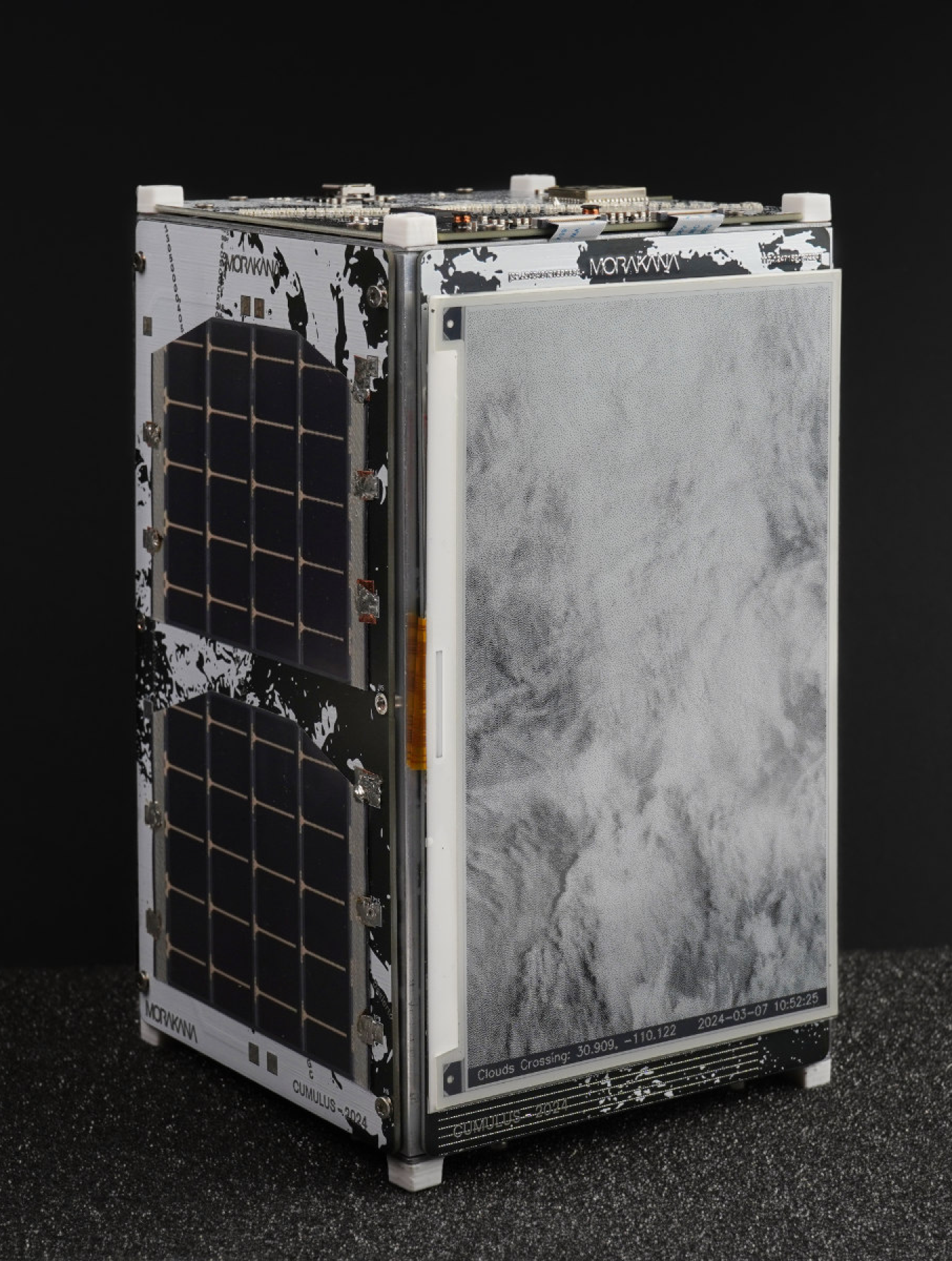
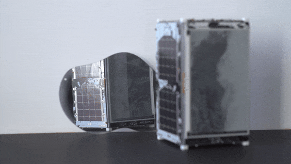
Cubesat-like networked device monitoring the Mexican-US border searching for clouds crossing the geopolitical division.
Using near-real time satellite images, Cumulus offers a global perspective free of political demarcations, embodying the Overview Effect, a cognitive shift in awareness experienced by astronauts by viewing the earth from outer space.
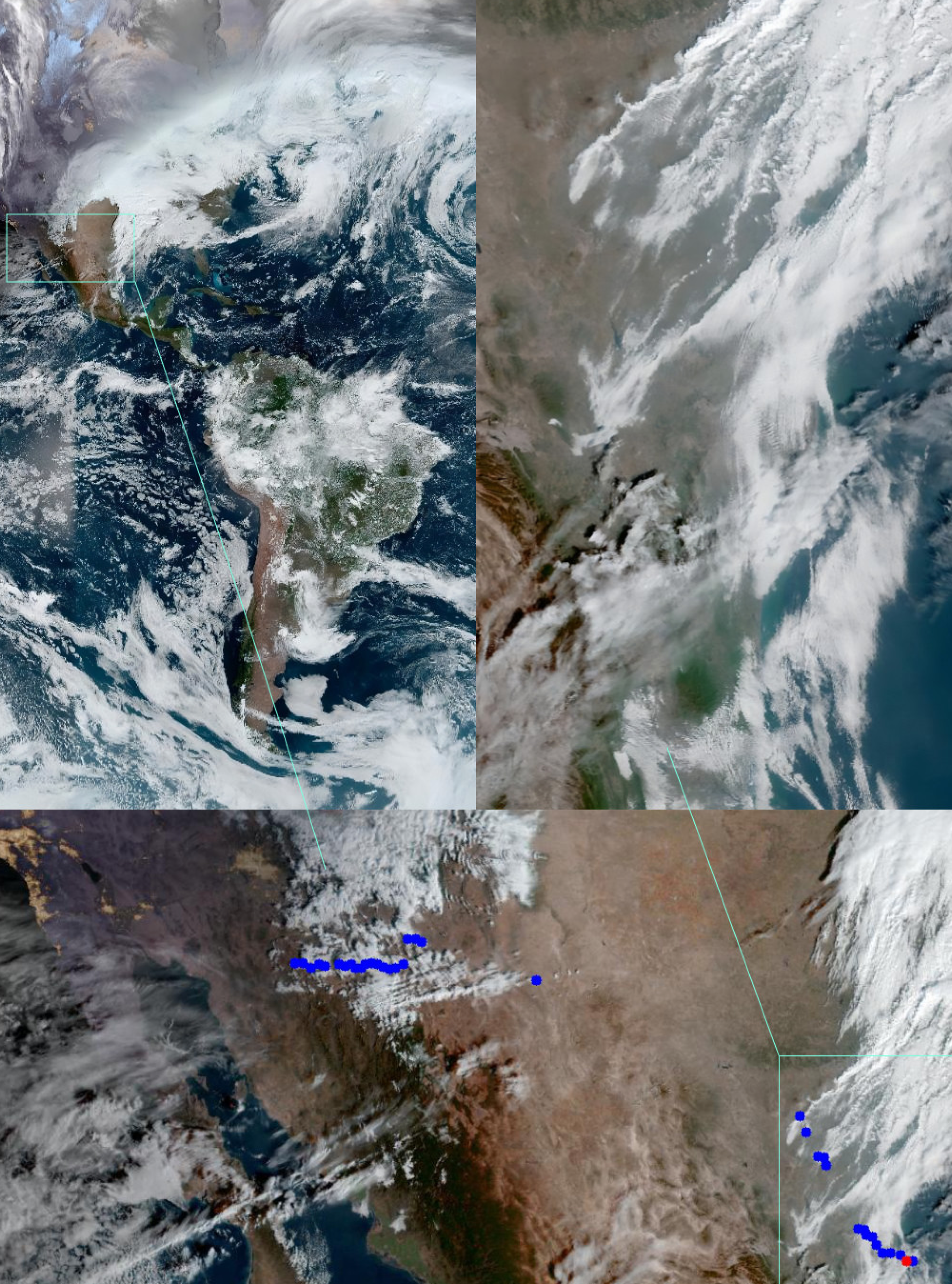
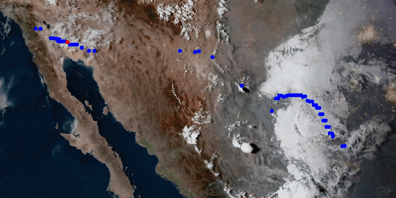
Cumulus uses a custom program to look at the American Continent as captured by NOAA satellites. Computer Vision algorithm analyzing the Mexico-US border, and focuses on a particular area with high concentration of clouds crossing the geopolitical division.
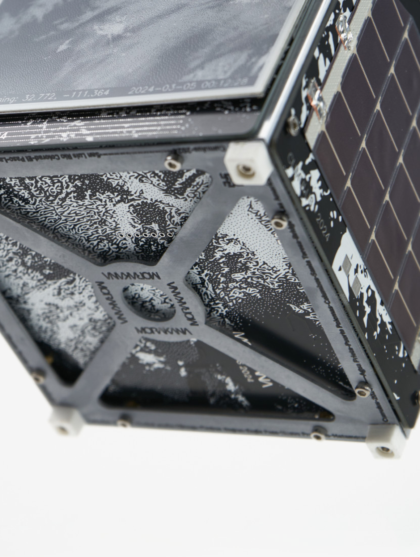
Cumulus detail top view showing LEDs representing the border. The red LED represents the area shown on the e-ink display where a cloud was identified crossing.
Cumulus employs two electronic paper displays to slowly render the ever-changing atmospheric bodies. These displays, updating in near-real-time, every 11 minutes, offer the audience a total view of the American Continent on one screen, while the other provides a focused view on clouds as they flow freely across the river, the desert, the walls, or the coastlines between Mexico and the United States; a line over 3000km long and the most transited in the world.
At the heart of Cumulus is the embodiment of the Overview Effect, a cognitive shift in awareness often reported by astronauts when viewing the Earth from outer space.
Using NOAA satellite images and CubeSat-inspired design, Cumulus contrasts the division imposed by politics and the constant flow of bodies, highlighting how borders are arbitrary, constructed, invisible from a higher perspective, yet have real, profound impact in our lives.